|
|
Lukenie Landscape |
|
|
Click on image for larger version
|
|
Lukenie Landscape |
|
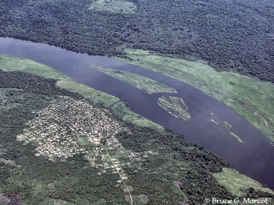
Lukenie River and Village |
Credit & Copyright: Dr. Bruce G. Marcot
|
Explanation: Deep in the heart of the Congo River Basin of central Africa runs the Lukenie River, a tributary eventually to the Congo River further west and a major artery of transportation itself among incredibly isolated villages. The dense forests lining the river become flooded during the wet season (although much rain falls also during the "dry" season), allowing people to boat into, and fish within, the dense jungles. During the low water season (June, July, August) larger barges do not dare to ply even the lower reaches of this river, as they will become stranded on shallow shoals. And the barges -- carrying people, goods, and supplies -- generally cannot reach this far up-river at all, leaving transportation only to small dug-out pirogues. |
Next week's picture: Before the Eruption
< Previous ... | Archive |
Index |
Location | Search | About EPOW | ... Next >
|
|

Author & Webmaster: Dr.
Bruce G. Marcot
Disclaimers and Legal
Statements
Original material on Ecology Picture of the Week ©
Bruce G. Marcot
Member Theme of The Plexus