EPOW - Ecology Picture of the Week

Each week a different image of our fascinating environment is featured, along with a brief explanation written by a professional ecologist.

22-28 June 2015

Click on images for larger versions

The Surprising Lava Fields of Imuruk

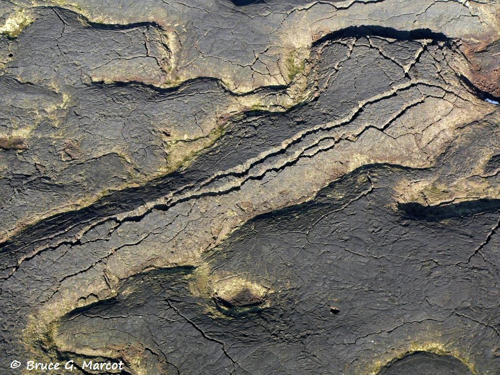
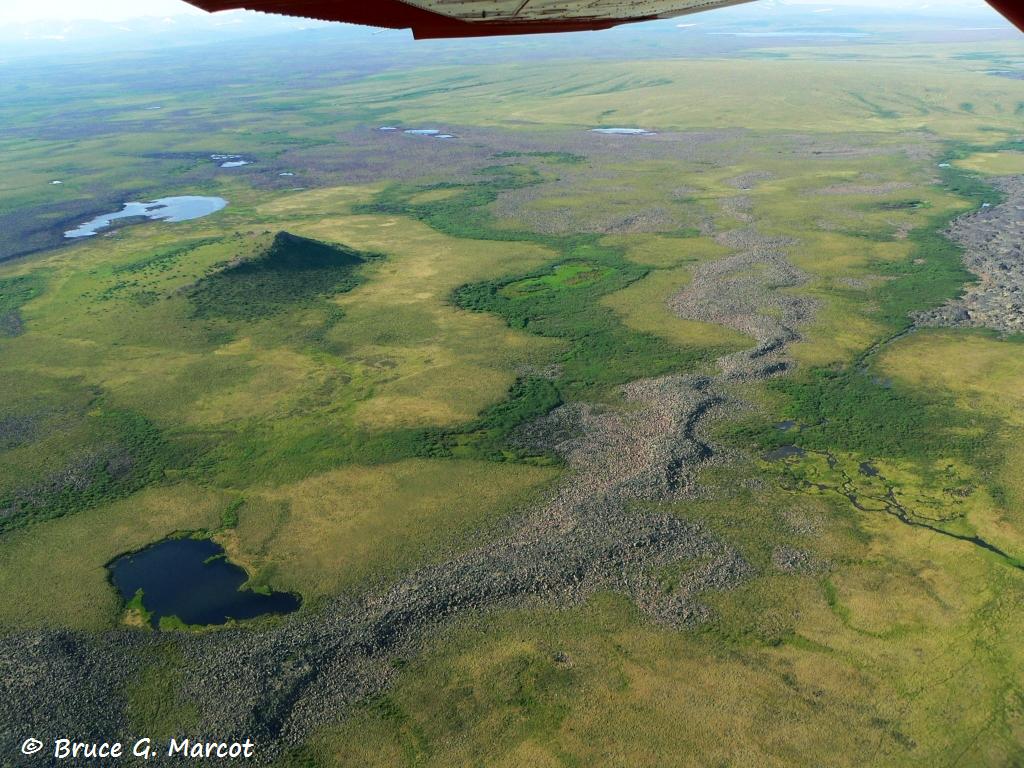
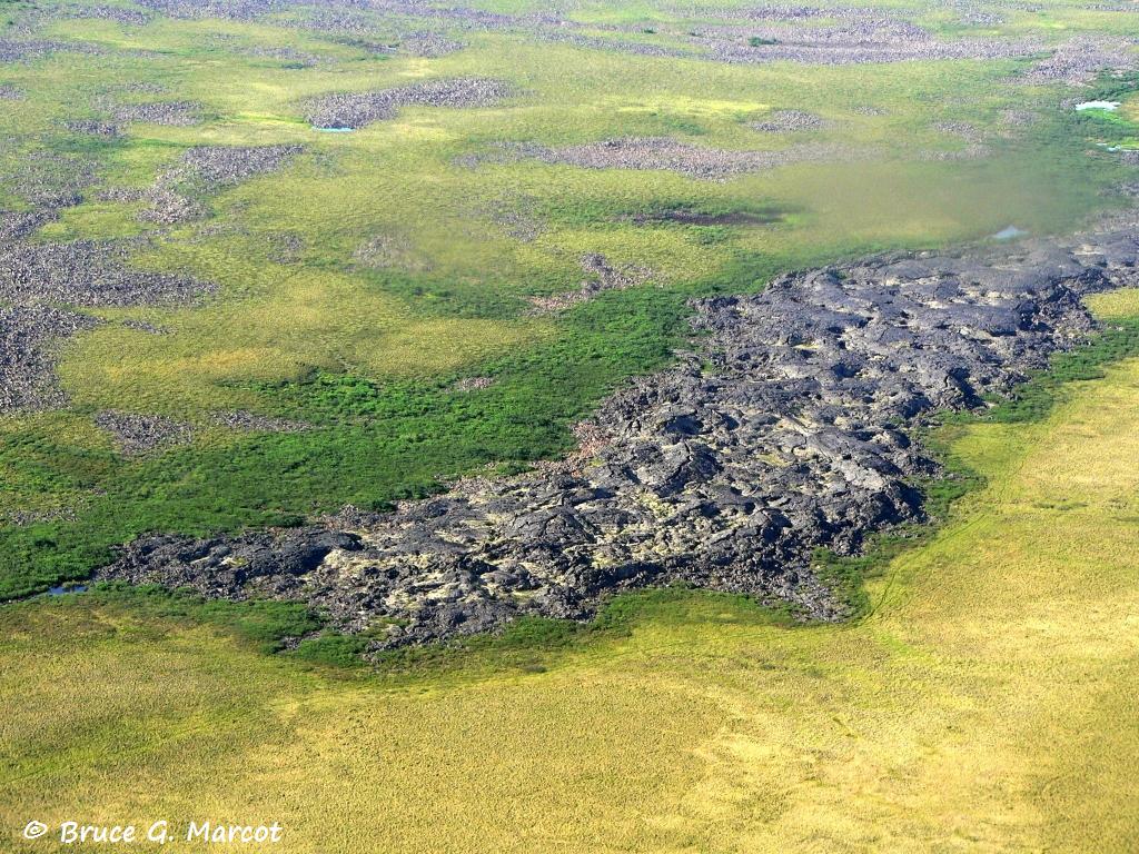
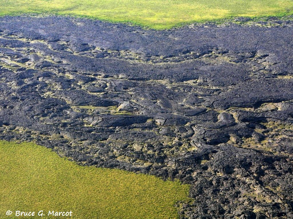
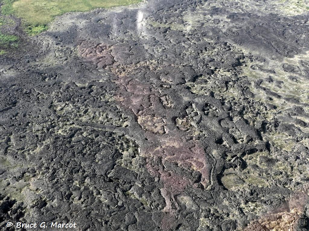
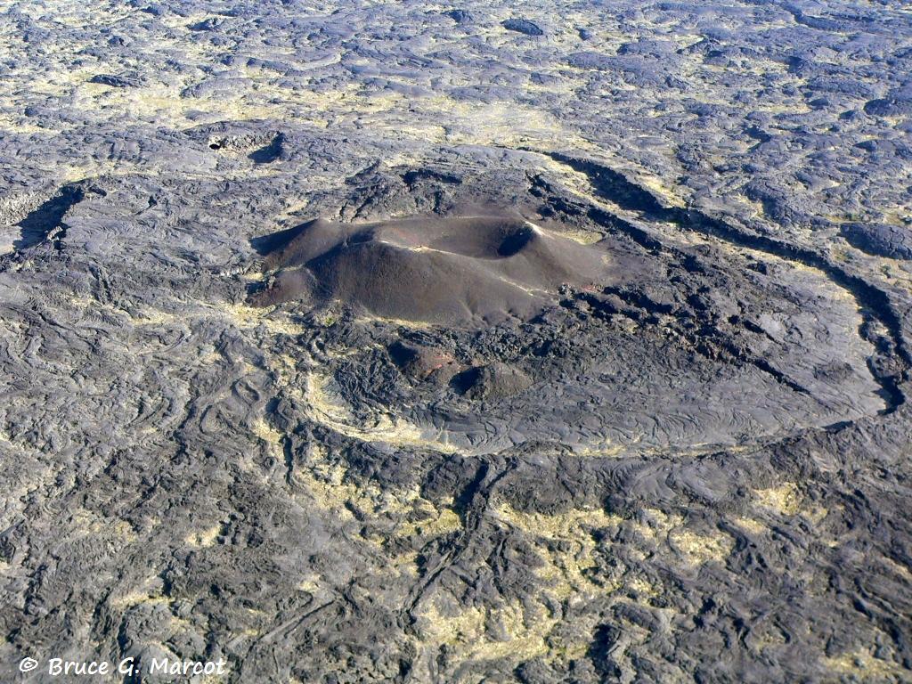
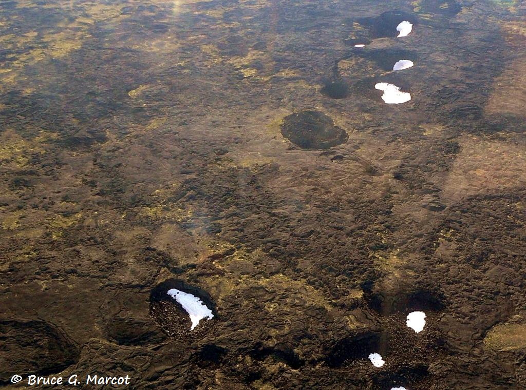
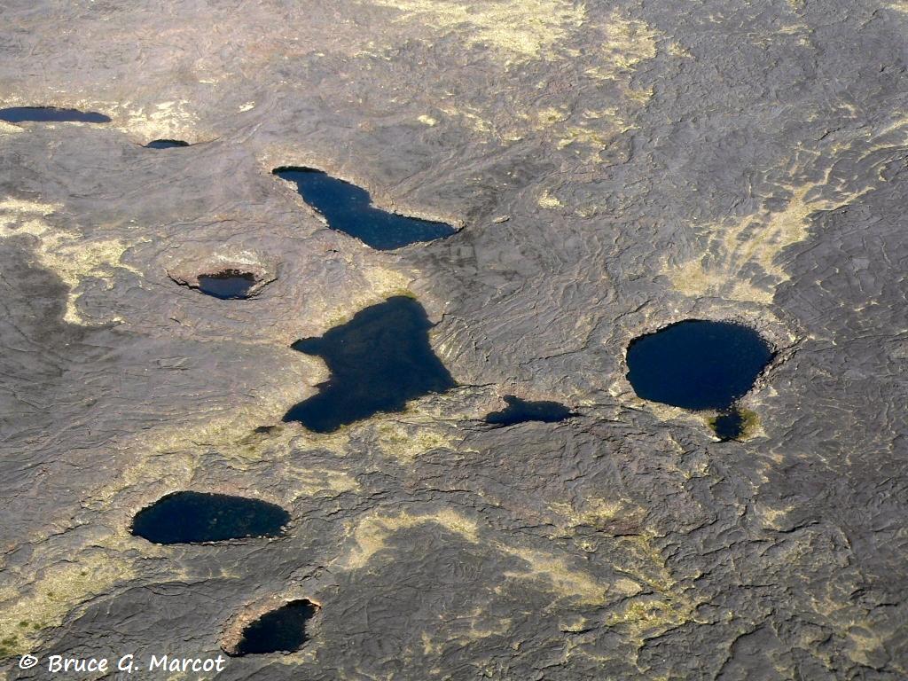
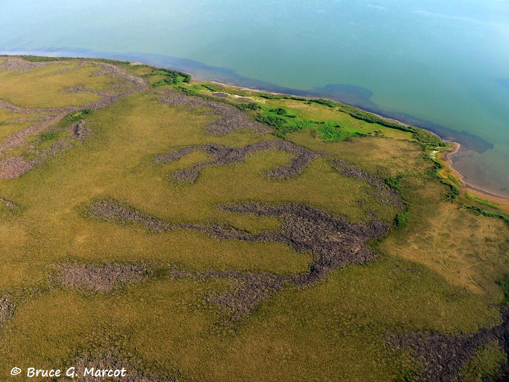
Imuruk Lava Beds Landscape, Bering Land Bridge National Preserve
Alaska

Credit & Copyright:  Dr. Bruce G. Marcot

Explanation:  This week, we are flying in a tiny 4-seater Cessna 185 airplane into the subarctic and arctic hinterlands of northwest Alaska at only 1,000 feet (about 300 m) altitude on a scientific photographic expedition.  Our plane is equipped with floats instead of tires, so we can land on tundra lakes.  

But below us suddenly stretches a vast volcanic landscape with no place to land.  We are flying over the Imuruk Lava Beds in the interior of Bering Land Bridge National Preserve.  

Sometimes the arctic throws an amazing surprise at you.  Most people do not realize that the once-vastly wide Bering Land Bridge, here on Seward Peninsula at the very edge of the North American Continent, is -- or was -- volcanic in origin, at least in part.  And that the Imuruk Lava Beds extend a rather astounding 100,000 acres (about 40,500 ha) in area, and the broader lava fields form a plateau covering some 900 square miles (576,000 acres or 233,100 ha) !


The northern edge of the Imuruk Lava Beds has exposed
stringers of lava flows, interspersed with tundra lakes and vegetation.


The extrusive lava fields punctuate the tundra landscape.


Notice the cracks in the lava domes.
These may signal extensive lava tubes and caves
(see also this week's main photo above).
Perhaps some had been explored and used for shelter by ancient peoples
as they spread across the Bering Land Bridge 12,000 years ago or longer.
But many may remain unexplored.


How I would love to spelunk those tubes and caves.
I would expect to find den sites and hiding sites of mammals.
But who knows what ancient human artifacts, or undiscovered
organisms and ecosystems, may lie within?


Here is a fine example of a cinder cone that once spewed
ash, pyroclastic debris, and lava bombs onto the surrounding lava fields.
Imuruk Lava Beds consist of over 200 feet (61 m) of lava which
flowed mostly northward along existing river valleys.


Now, this is an amazing find -- various pits apparently resulting
from collapse of lava dome roofs.
Note how snow and ice has remained in the sheltered, shaded recesses.
I wonder if this is similar to the mysterious ice pits that
have been photographed on the surface of Mars?


Lakes have filled in some of the lava pits.
There is scant vegetation visible here, compared with other tundra lake
areas, but perhaps the lakes have been colonized by micro-organisms.
Early people inhabited the adjacent, large Imuruk Lake for caribou hunts.


Some lava arms also extend to the coastline and beyond, along northern Bering Strait.


Next week's picture:  The Fox and the Hare


< Previous ... | Archive | Index | Location | Search | About EPOW | ... Next >


Google Earth locations
shows all EPOW locations;
must have Google Earth installed

Author & Webmaster: Dr. Bruce G. Marcot
Disclaimers and Legal Statements
Original material on Ecology Picture of the Week © Bruce G. Marcot

Member Theme of  The Plexus