|
|
|
Photographic Legacy for Climate Change Research |
|
|
Click on image for larger version
|
|
|
Photographic Legacy for Climate Change Research |
|
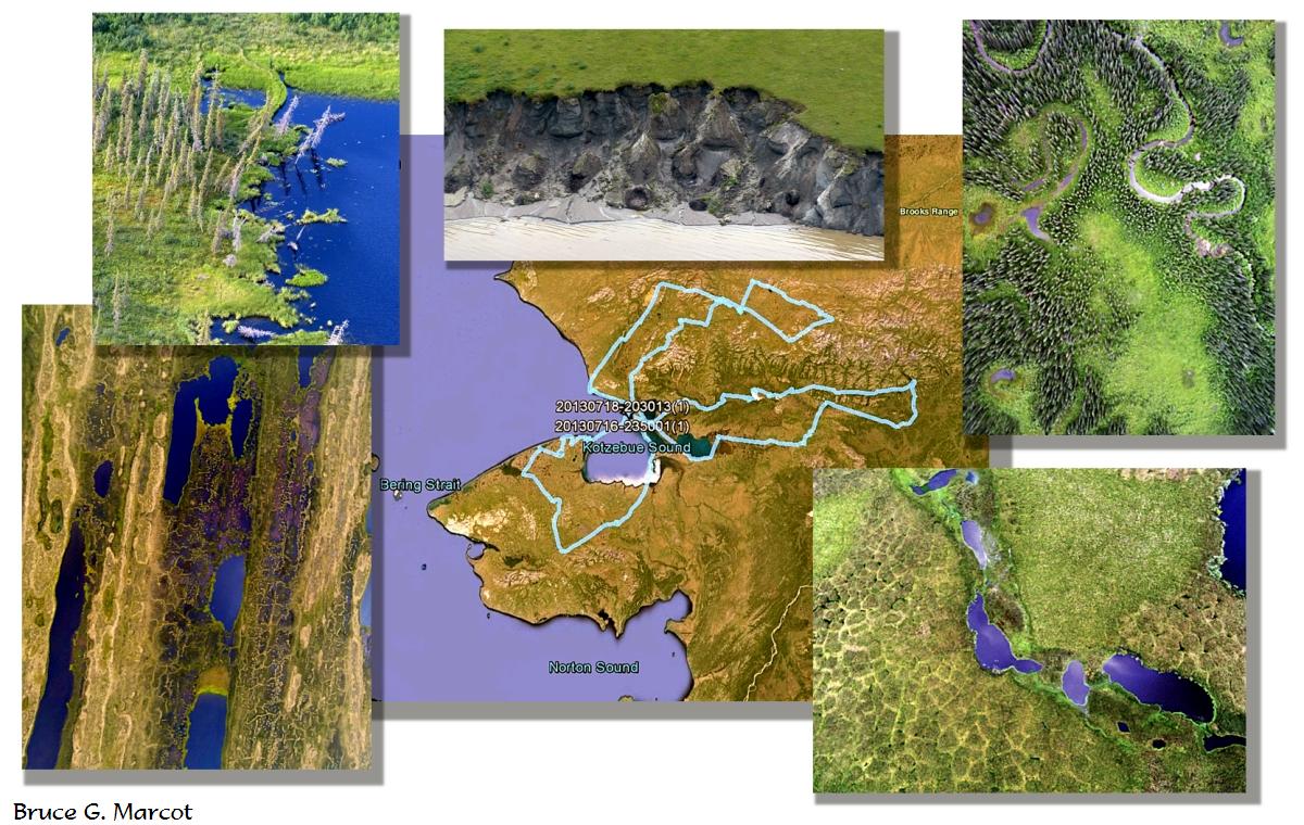
Tundra, shoreline, lake, and forest
conditions of the arctic and subarctic |
Credit & Copyright: Dr. Bruce G. Marcot
|
Explanation: This week I present a montage I created from photos taken during a major set of flights over the arctic and subarctic of northwest Alaska. These are but a tiny sample of an immense catalog of photos and videos to document current conditions from which future changes can be measured. During July 16-18, 2013, my ecologist colleague Dr. Torre Jorgenson and I flew in tiny, four-seater airplanes -- a Cessna 185 with floats for landing on tundra lakes, and a Cessna 206 with oversized "tundra tires" for landing on remote river bars and tundra river banks. I outfitted each plane with two cameras (a GoPro and a Drift camera) secured to the underwing or undercarriage and set to do timelapse photos at 5-second intervals. We also had three additional cameras, hand held, shooting through the planes' windows. Over three days, we flew 1,609 miles (2,5590 km) into some of the most remote wilderness on the planet, and took a total of 19,167 photos, as well as enough high-resolution videos to provide 290,580 individual frames. Each photo is geotagged to precise latitude and longitude, as is the entire set of flight paths, shown as the blue routes in the center of the montage, above. This is so future researchers can return to the same paths and locations and record conditions altered due to climate change and related dynamics of this fast-shifting high-latitude realm. The publication detailing this project is available at https://pubs.er.usgs.gov/publication/ds846.
|
Next week's picture:
Muskox Madness
< Previous ... | Archive |
Index |
Location | Search | About EPOW | ... Next >
|
|

Author & Webmaster: Dr.
Bruce G. Marcot
Disclaimers and Legal
Statements
Original material on Ecology Picture of the Week ©
Bruce G. Marcot
Member Theme of The Plexus