|
|
|
The Changing Arctic: Drained Lakes |
|
|
Click on images for larger versions
|
|
|
The Changing Arctic: Drained Lakes |
|
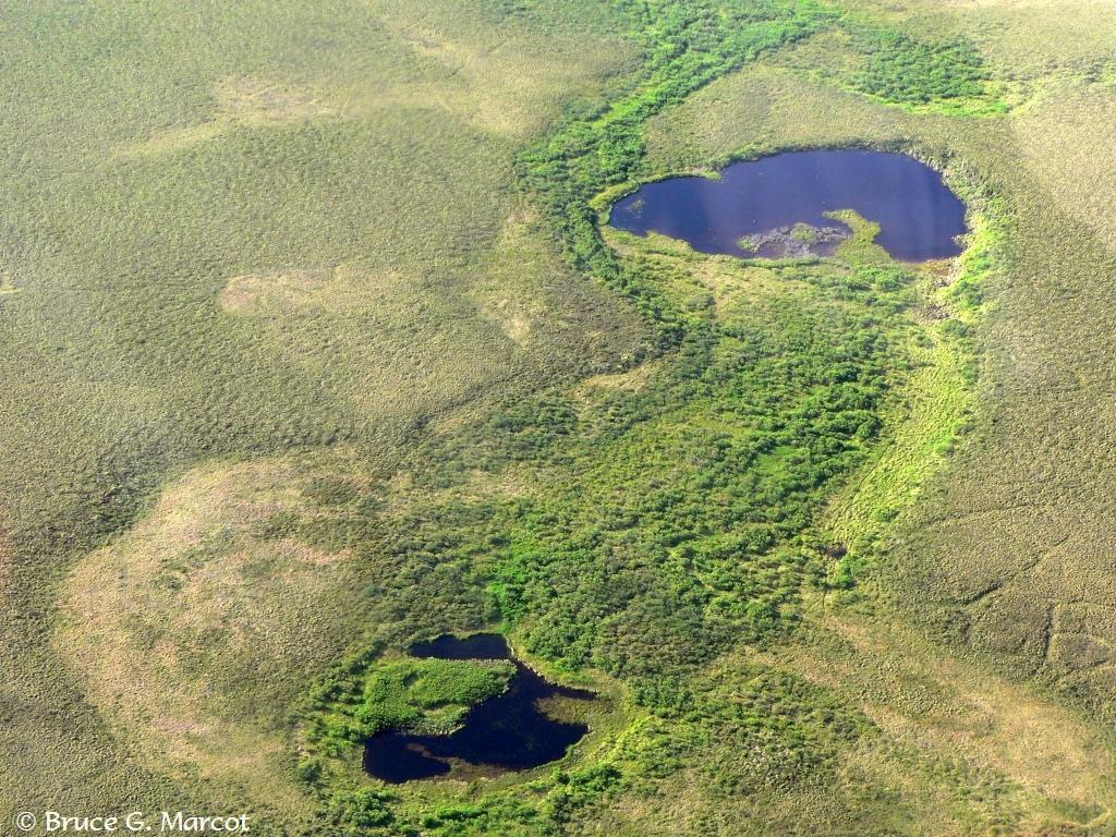
Drained thermokarst lake |
Credit & Copyright: Dr. Bruce G. Marcot
|
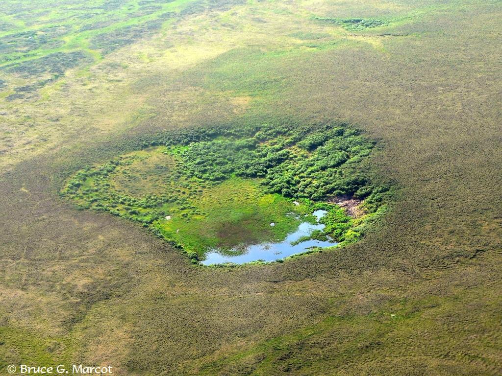
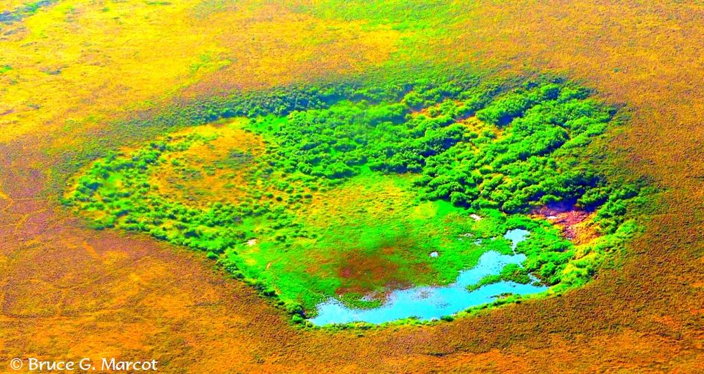
Explanation: This week we are in extreme western Alaska out on the Seward Peninsula that, during the Pleistocene and the height of the last global glacial maximum, united Asia with North America across the Bering Strait. Part of the Seward Peninsula has been designated a national park -- the appropriately-named Bering Land Bridge National Park, in fact. But it is here where we are seeing stark evidence of changes occurring again throughout the high Arctic. In the main photo, above, we are viewing a thermokarst (ice-melt) lake that has nearly completely drained. When the permafrost (frozen ground) below the "active layer" (seasonally-thawed surface) of the soil melts because of changing climate climate and increasing annual temperatures, such lakes can drain like bathtubs when the drain plug is removed. What is left is a depression with residual ponds in the lowest sections. The lake
basins are then often deeply thawed, and rich and moist with organic sediments
that support vigorous vegetation growth, as shown in the following photos and
examples from the same area:
Whether there is a net loss, draining, and drying of lakes throughout the Arctic, as caused by increasing temperatures and melting of the permafrost layer, is currently being studied. Regardless, so many tundra lakes in the region have apparently become drained due to permafrost melt and other dynamics, that it may be a concern for wildlife that depend on these ecosystems.
|
Next week's picture: The Common and Wonderful Snail of the Mangroves
< Previous ... | Archive |
Index |
Location | Search | About EPOW | ... Next >
|
|

Author & Webmaster: Dr.
Bruce G. Marcot
Disclaimers and Legal
Statements
Original material on Ecology Picture of the Week ©
Bruce G. Marcot
Member Theme of The Plexus