|
|
|
The Dalton and the Pipeline |
|
|
|
|
|
The Dalton and the Pipeline |
|
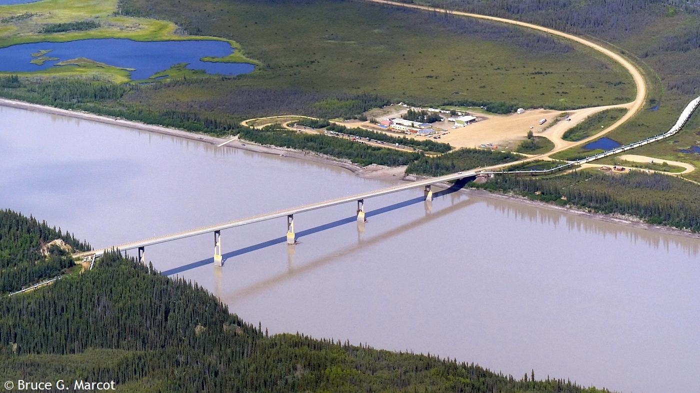
Dalton Highway and Trans-Alaska
Pipeline |
Credit & Copyright: Dr. Bruce G.
Marcot
|
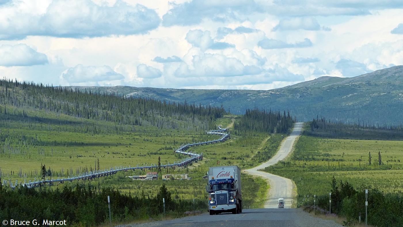
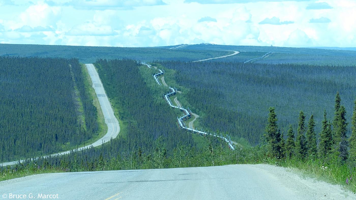
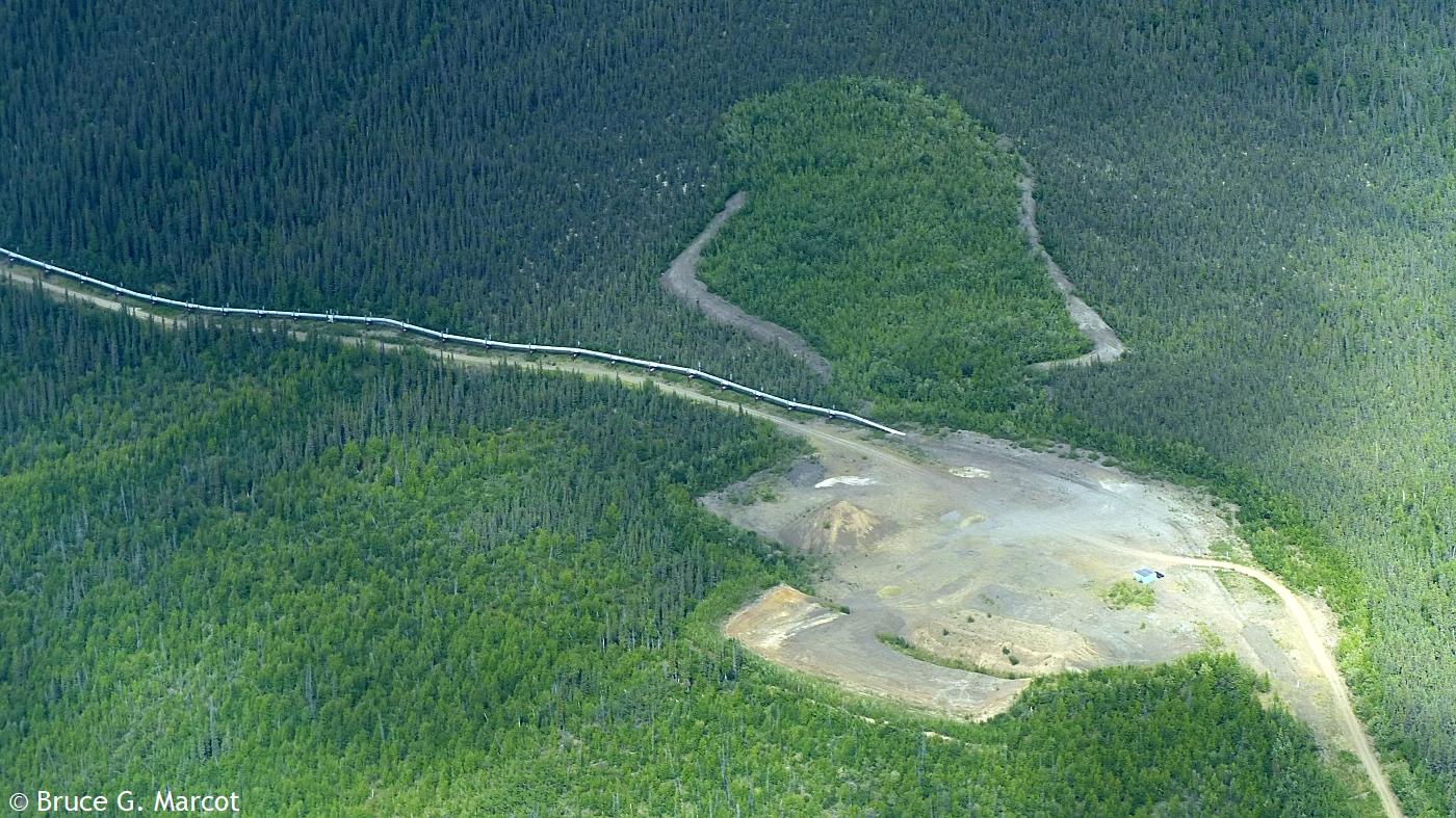
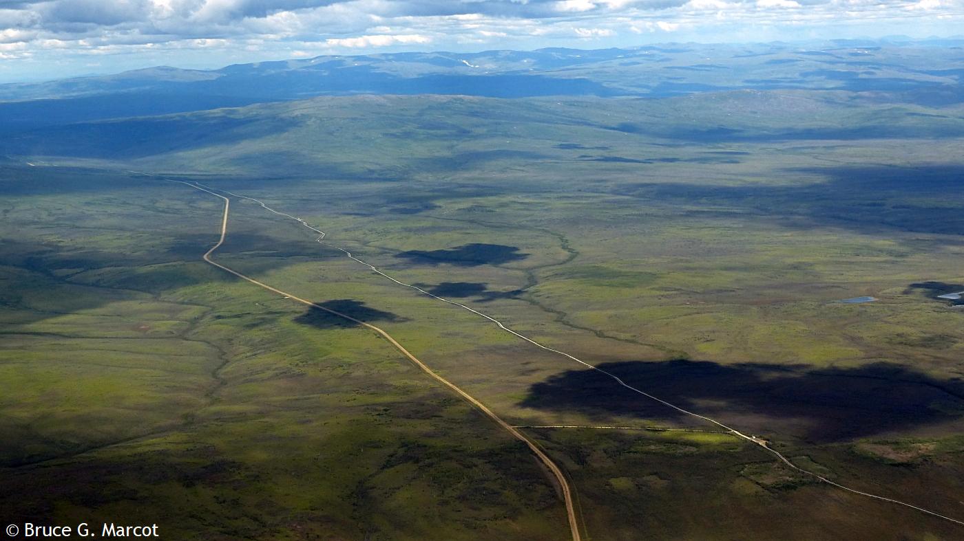
Explanation: Welcome to the Haul Road, as it is colloquially called. We are in arctic Alaska, on the Dalton Highway, a.k.a. North Slope Haul Road (and officially known as the James W. Dalton Highway), heading north past Anaktuvuk Pass, through the northern foothills of the Brooks Range. You can see by the above photo why it's called the Haul Road, serving as a major corridor for trucks hauling goods and resources north and south. But also there runs the 800-mile (1,287-km) long Trans-Alaska Pipeline, first installed in the mid-1970s, to transport oil from Prudhoe Bay and offshore drilling stations southward to the Gulf of Alaska for further ship transport south. The highway follows the course of the pipeline (or vice versa) through remote arctic lands of white spruce and tundra. Along several adventures on (and flying above) the highway, I saw how both highway and pipeline carve along the topography of these boreal and arctic lands.
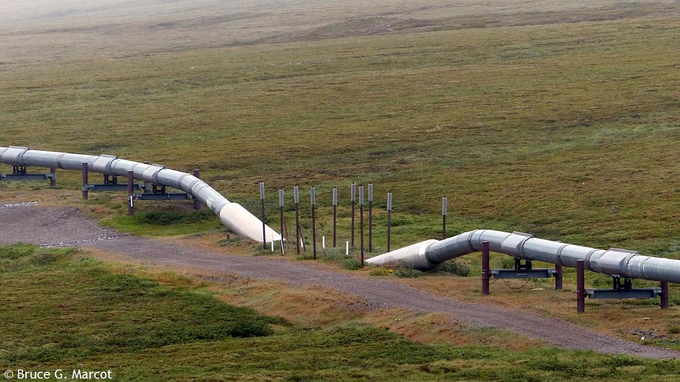
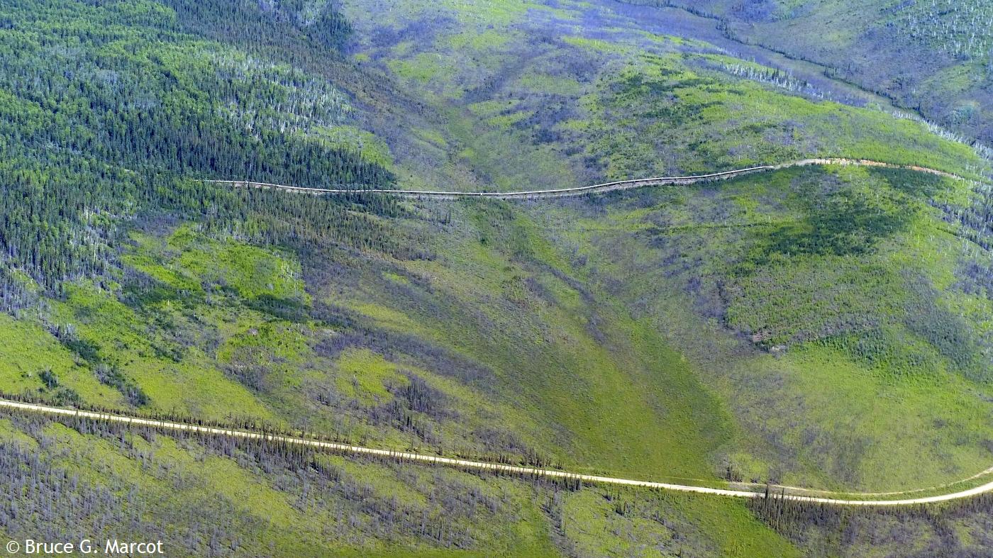
But here, the pipeline dives
underground for only a few feet! Why? And what are all those
poles?
And on it goes, highway racing the pipeline (or vice versa?), across the spruce landscapes and barren tundra, across the mountains, feeding our energy-hungry society with the blood of the Earth. But now, there may be grave threat to the pipeline from regional climate warming and thawing of the permafrost!
|
Next week's picture: Woolly Bear
< Previous ... | Archive |
Index |
Location | Search | About EPOW | ... Next >
Google Earth locations
shows all EPOW locations;
must have Google Earth installed
Author & Webmaster: Dr. Bruce G. Marcot
Disclaimers and Legal Statements
Original material on Ecology Picture of the Week © Bruce G. Marcot unless denoted otherwise