|
Explanation: Did you
know that there is a vast area of sand dunes in the Arctic? Sand?
In the Arctic? Where is this, and how can this be? This
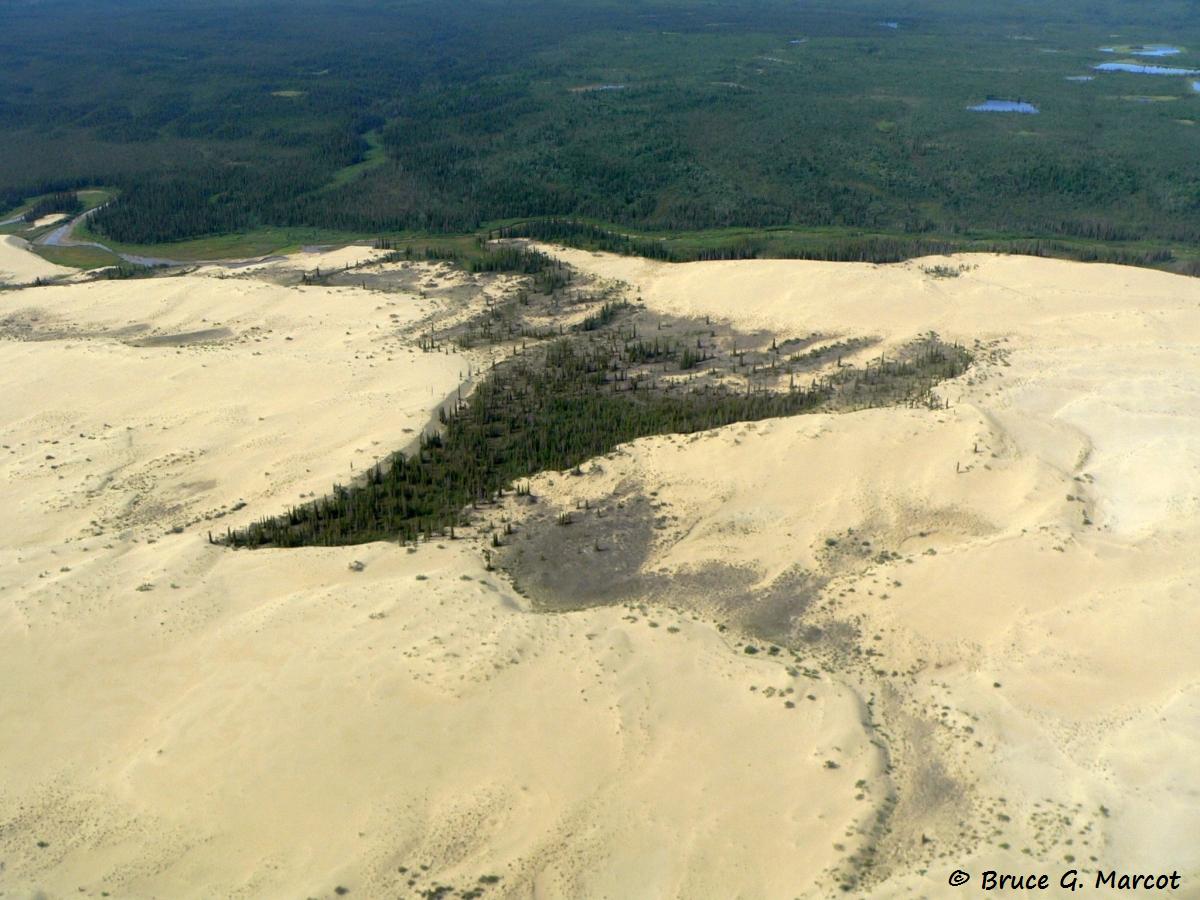
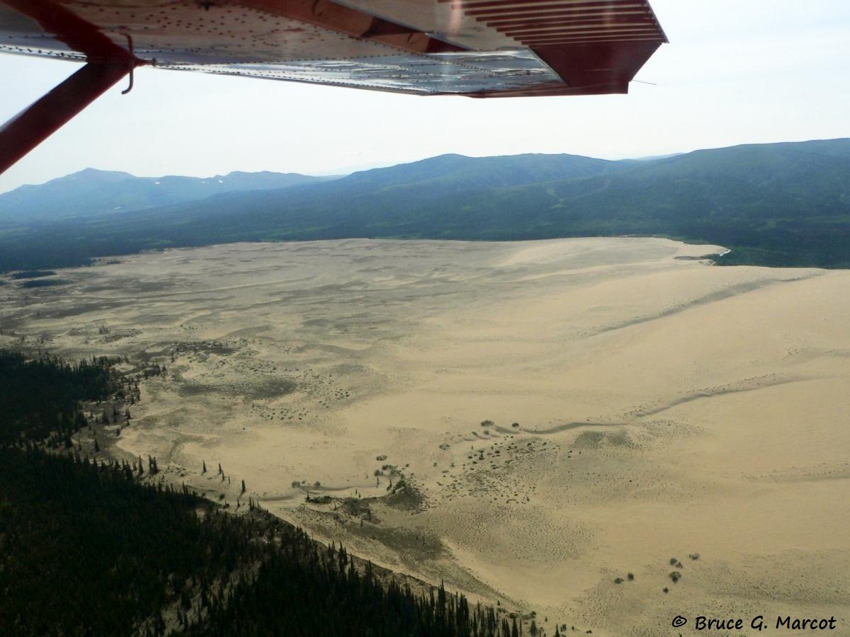
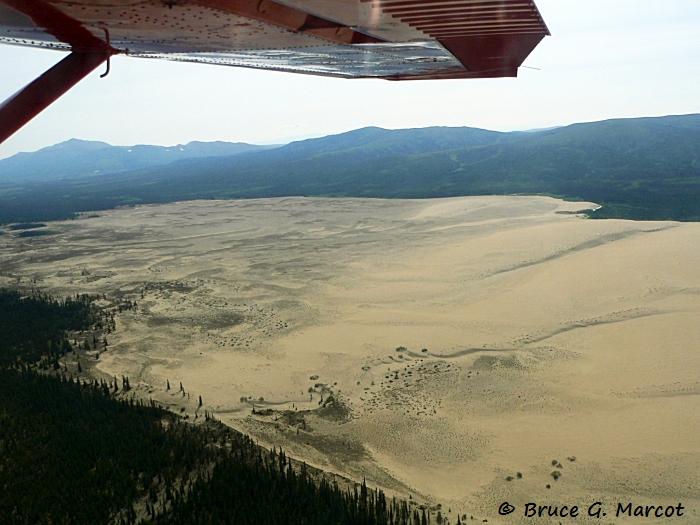
is the Great Kobuk Sand Dunes, found in the very remote Kobuk Valley National
Park, in northwest Alaska. We are above the Arctic Circle and in a region of
white spruce boreal forest. This
massive area of bare dunes covers about 20,500 acres (8,296 hectares).
But the sand also extends well beyond the edges of the bare dunes, underneath
the forest, covering a total massive area of about 200,000 acres (80,937
hectares) or over 312 square miles (809 square kilometers).
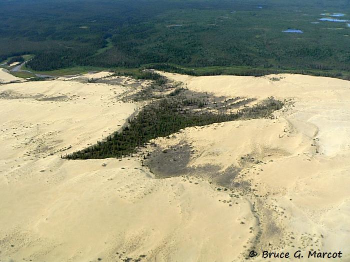
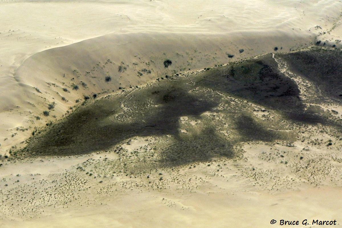
Some of these dunes reach over 100 feet high,
dwarfing the forests that struggle to maintain a foothold
in the ever-shifting matrix.
The dunes
formed during inter-glacial periods when strong winds pushed sand and silt
from the outwash plains created by the glaciers into this region, piling up
into this deep and extensive field.
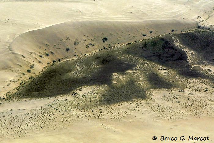
Pockets of vegetation occur in the dune field,
locally and briefly stabilizing the sand.
Here one can find tracks of local wildlife including
bears, wolves, and even caribou that trek across the area
during the annual migrations.
The region is little-visited, as the park has no
roads, and bush flights are the only viable way in
and out. 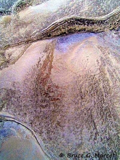
In
the video presented above are images from a GoPro camera that I lashed to the
under-struts of the bush plane we took on one of my overflights of the
region. I
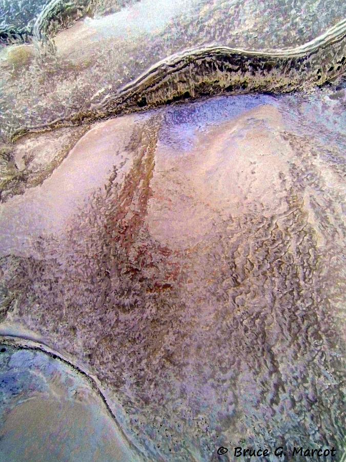
enhanced the contrast, color, and gamma of the time-lapse images. These
enhancements better show the rough topography of the dune surface as shaped by
wind, snow, and ice. But
they also hint at areas kept more snow-free because of dune-face slippage,
layers of cracked wet sand, sinkholes, tensional rifts, and other features (Koster
and Dijkmans 1988).
Few biological researchers have studied the dunes,
although geophysicists and others have reconstructed
the Holocene history of the region by using carbon dating
of lake-sediment cores taken from the region (Mann et al. 2002). They
found no less than four major periods of sand deposition
over the last 8000 years, the most recent ending just
a century ago. The periods of sand deposition and
intervening
periods of dune shrinkage coincide with fluctuating
aridity and humidity of the region.
Although remote-sensing imagery has revealed
that dunes are undergoing slow migration (Necsoiu et al. 2009),
how current climate change trends will affect
the future of the dunes is yet to play out.
Information:
Koster, E.A. and J.W.A. Dijkmans.
1988. Niveo-aeolian deposits and denivation forms, with special
reference to the Great Kobuk Sand Dunes, Northwestern Alaska. Earth
Surface Processes and Landforms 13(2):153-170.
Mann, D.H., P.A. Heiser, and B.P. Finney.
2002. Holocene history of the Great Kobuk Sand Dunes, Northwestern
Alaska. Quaternary Science Reviews 21(4-6):709-731.
Necsoiu, M., S. Leprince, D.M. Hooper, C.L.
Dinwiddie, R.N. McGinnis, and G.R. Walter. 2009. Monitoring
migration rates of an active subarctic dune field using optical
imagery. Remote Sensing of Environment 113(11):2441-2447.
|