|
|
|
A Place for Intensive Forest Management |
|
|
Click on images for larger versions
|
|
|
A Place for Intensive Forest Management |
|
Cedar River Municipal Watershed |
Credit & Copyright: Bruce G. Marcot
|
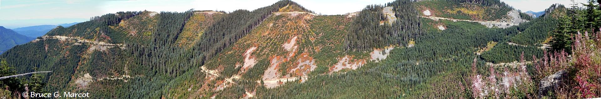
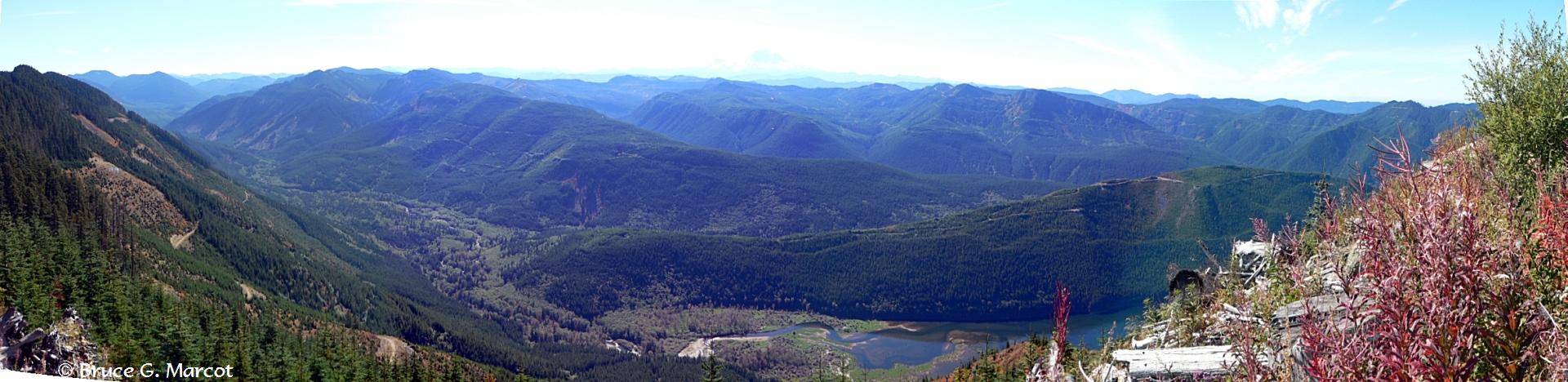
Explanation: These two contrasting views of forested landscapes were taken from the same spot! I merely spun 180 degrees around. The top view, above, shows some striking forestry cut blocks designed to maximize sunlight after harvesting to stimulate growth of planted trees, and to retain mature forest cover that can serve as travel corridors for elk and other wildlife up to and over the saddles along the mountain ridges. The bottom view shows more intact forest cover on the other side of the river, looking into state and federal lands. This is the Cedar River Municipal Watershed, an area of 90,638 acres (36,680 ha) located in the Cascade Mountains of Washington State, USA. The watershed is managed by Seattle Public Utilities for multiple purposes, primarily for a source of water for the greater Seattle area (it provides for 70% of the needs of 1.4 million people), and for a source of wood and timber. Other uses include providing habitat for a variety of fish and wildlife. Are these competing uses? The managers think not, and have crafted very detailed management guidelines that dictate timber harvest schedules, locations, and forest planting and recovery activities to meet the multiple objectives. Some may argue that clearcutting these forests that are largely dominated by Douglas-fir (Pseudotsuga menzeisii) creates environmental problems. Others may argue that protecting intact forests is a more appropriate objectives, as less than 17% of the original old-growth forest remains in the watershed. Still others may assert that the timber is a renewable resource, when properly managed, that will provide revenue for the City in perpetuity. To help present the issues, the City has developed the Cedar River Watershed Education Center. What do you think?
|
Next week's picture: Crop Circles of the Sahara
< Previous ... | Archive |
Index |
Location | Search | About EPOW | ... Next >
|
|

Author & Webmaster: Dr.
Bruce G. Marcot
Disclaimers and Legal
Statements
Original material on Ecology Picture of the Week ©
Bruce G. Marcot
Member Theme of The Plexus