Click on the images for larger versions
|
|
Window
to Past Climates: |
|
|
Click on the images for larger versions
|
|
Window
to Past Climates: |
|
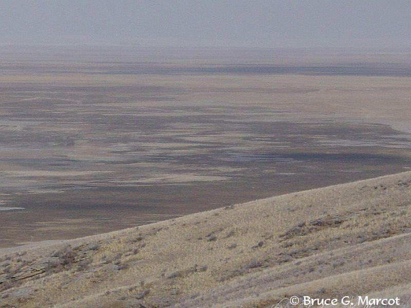
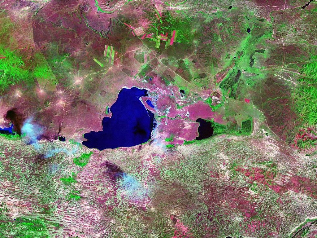
Dalai
Nur Lake, Dalai Nur Nature Reserve, |
Credit & Copyright: Dr. Bruce G.
Marcot
|
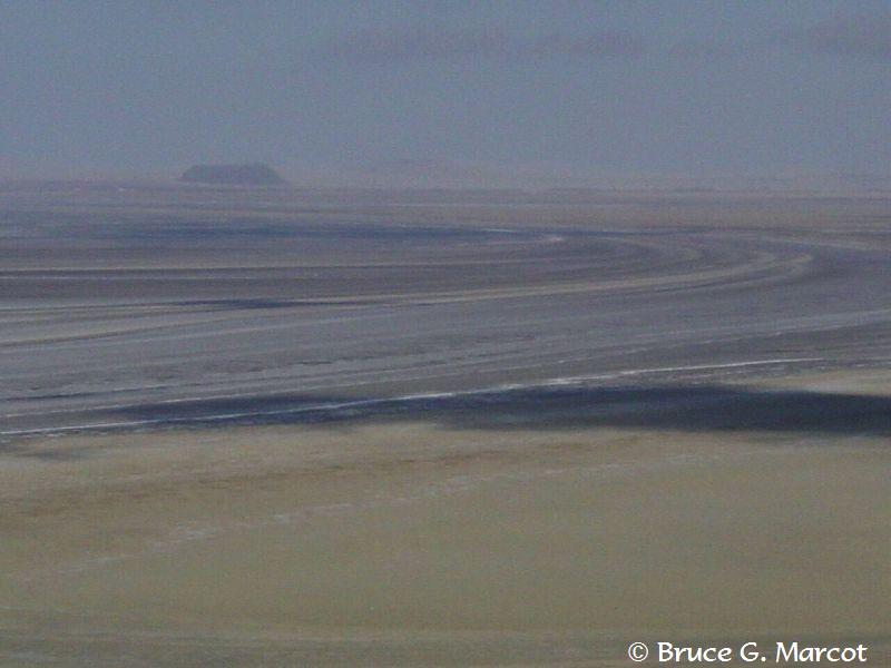
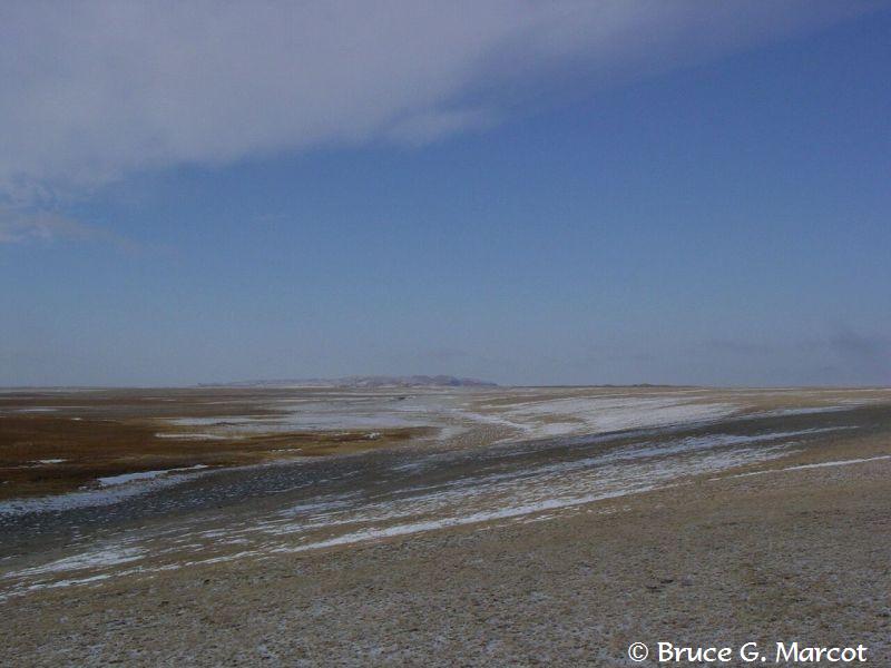
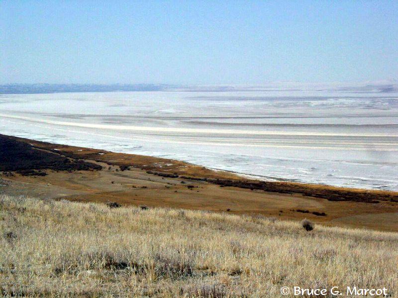
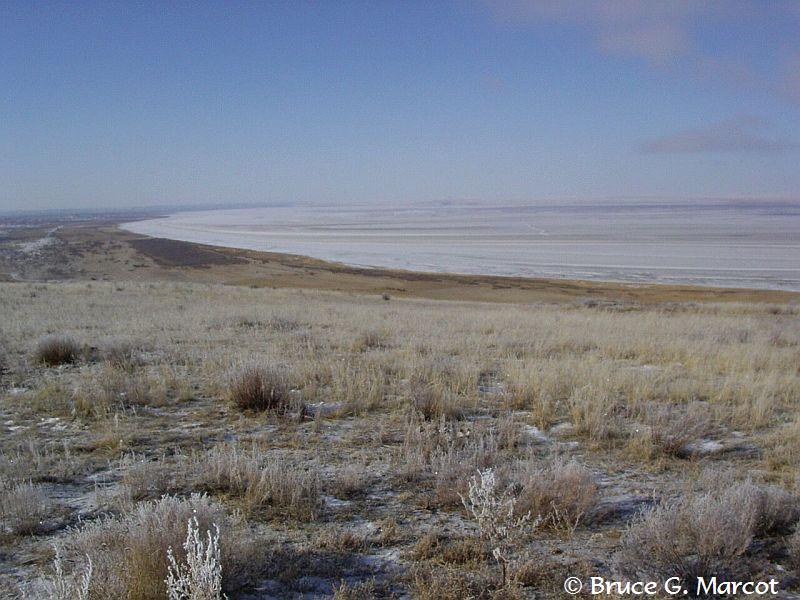
Explanation: It
is November, and we are in the frozen interior of Nei Mongol or Inner
Mongolia of China. Before us stretches ancient shorelines of the Historic and prehistoric fluctuations in the size of this lake are astounding. You can clearly see the ancient lakeshore lines extending tens of kilometers from the current shoreline. These are clear demarcations of many extreme variations in the local climate ... a window to past periods when the region was far more wet and likely far more lush with woodland vegetation. The area is now arid ... and in fact hosts the thinnest river in the world, the Haolai River that empties into Dalai Nur Lake. The
ancient shorelines extend up the side of extinct volcanic hills or
"plugs" that occasionally dot this bleak landscape. During
ancient times, these volcanic hills occurred as islands within the Dalai Nur
"inland sea" during one of its expansion periods. At least one
such island contains important
petroglyphs of wildlife long gone, although the lake and surrounding
wetlands of Dalai Nur Nature Reserve still host some 160
bird species during the warm summer thaw period. Various views of Dalai Nur Lake
shorelines
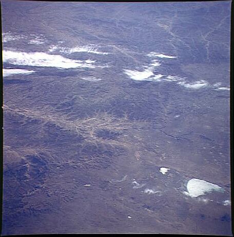
Gallery of space shuttle images of Dalai Nur
Lake.
|
Next week's picture: The Unicorn of India
< Previous ... | Archive | Index | Location | Search | About EPOW | ... Next >

Author & Webmaster: Dr.
Bruce G. Marcot, Tom Bruce
Disclaimers and Legal
Statements
Original material on Ecology Picture of the Week ©
Bruce G. Marcot
Member Theme of Taos-Telecommunity


