|
|
|
Tough Spot for Climate Change Study |
|
|
|
|
|
Tough Spot for Climate Change Study |
|
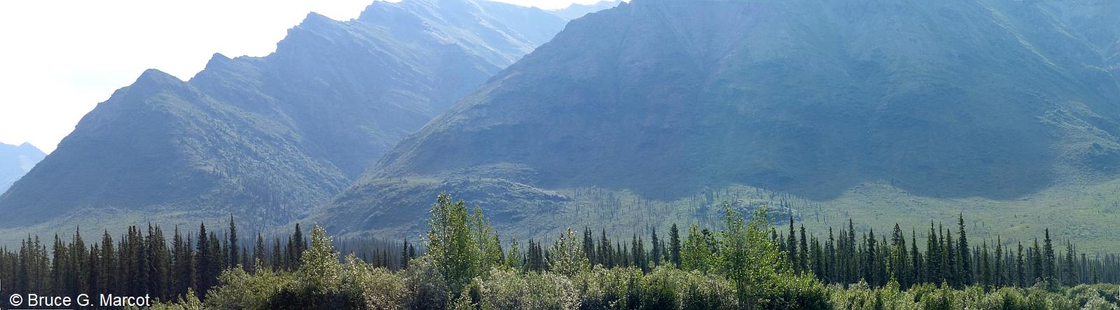
Gates of the Arctic National Park and Preserve, Alaska, USA |
Credit & Copyright: Dr. Bruce G.
Marcot
|
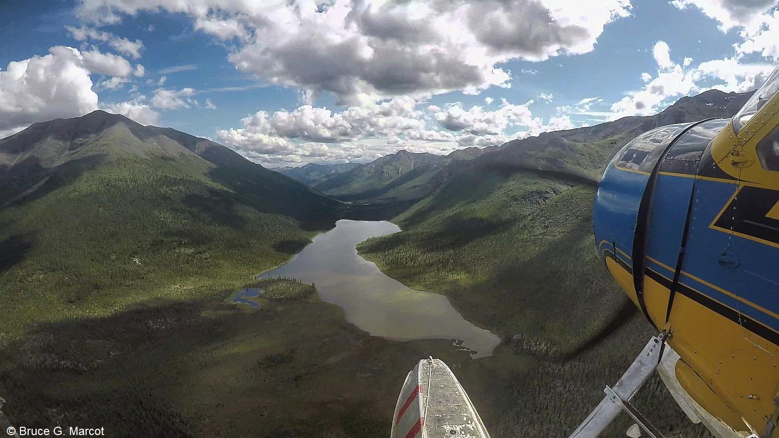
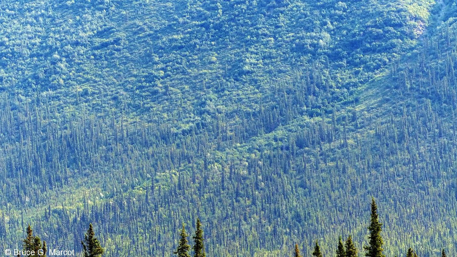
Explanation: Last week we explored a tundra location in the high arctic of Svalbard, Norway. This week's arctic expedition takes us into the most remote and seldom-visited national park in the U.S.: Gates of the Arctic National Park and Preserve of arctic Alaska.. In late June of 2017, a colleague and I hired a bush pilot to fly us from the tiny northern Alaskan settlement of Bettles into the eastern Brooks Range and into Gates of the Arctic. Gates of the Arctic occurs at about 68 degrees north latitude, just above and within the 66.5 degrees north latitude of the Arctic Circle. There are no roads here. Or trails. The only way in would be a massive trek or ... bush flights. Our aim was to scout out the heart of the park -- a steeply-walled and narrow river valley -- as a possible location for conducting a multi-year study on how climate change is influencing vegetation and wildlife of the region. It is known that climate change impacts in the arctic are occurring at about twice the rate as in more temperate latitudes further south, so a study here could provide an "early warning signal" of impending changes for the rest of us. But why this narrow valley? Look at the mountainside
here: the vegetation stretches upslope in very well-defined
patterns. Each vegetation zone contains a unique set of plants and
animals.
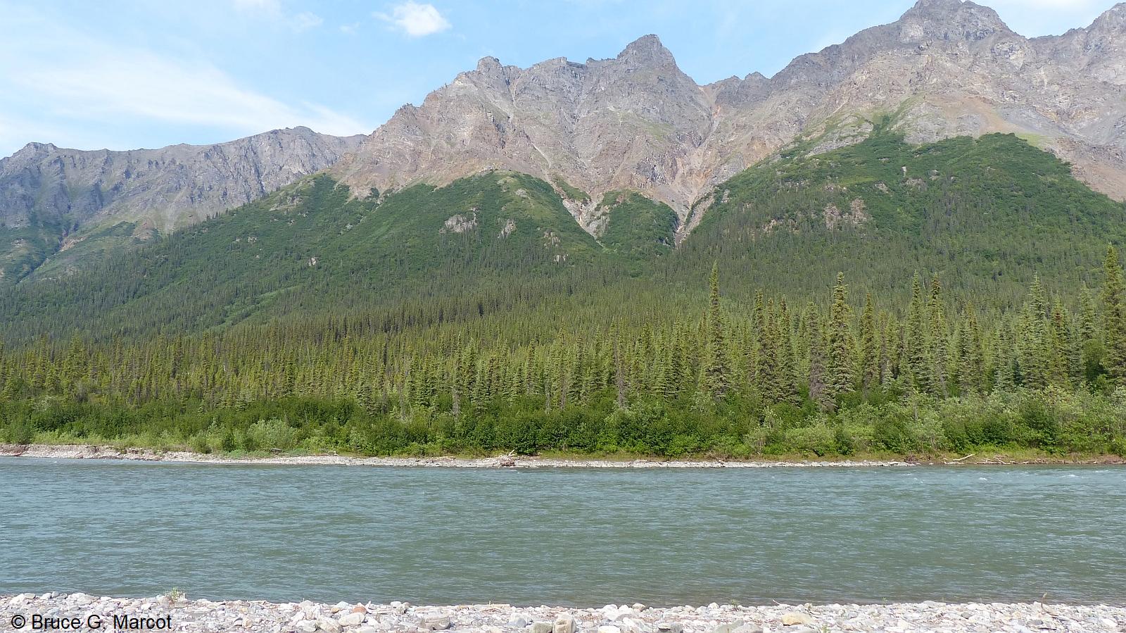
As shown in the photo immediately above, the lowest vegetation zone consists of riparian shrubs and hardwoods along the river's edge. Next
comes black spruce forest that extends upslope to where it transitions into
arctic shrub environments:
Over
time, under regional warming trends from climate change, each of these zones
would shift upslope, eclipsing one another. And the associated wildlife
of the region -- shrews, voles, moose, and much more -- would follow
suit. We could monitor their populations with a matrix of trail cameras
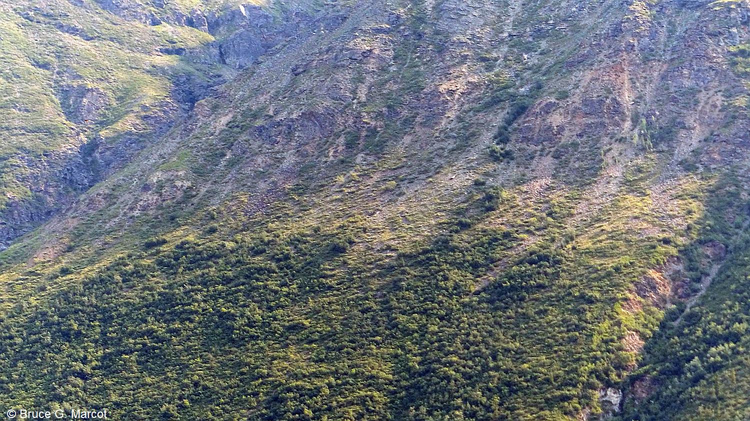
that would shoot video and still photos triggered by movement. All good. BUT ... after we scouted the location as an ideal and potential study site, we decided not to start the study there. The reasons: ... access is only by bush plane, very limited by local weather conditions, river levels, and season. The plane would need to take multiple trips to bring in all camping and study gear along with a small research team, who would stay on site likely for at least a few weeks to set up all monitoring equipment, take vegetation measurements, and get the study established. ... THEN, the only way out, with all samples taken, as the weather and river level would change, would be via river raft. We're not aware of anyone having rafted out of the park from here, or if it is even feasible. ... AND there is the concern of encountering brown bears that enjoy meals taken from field camps, so we would always need to remain wary and alert, and pack bear spray if not also a sidearm ... AND moose would likely wander through the riverside camp, and they can be incredibly unpredictable and territorial. ... AND FINALLY, the study would entail scaling these immensely steep and unstable cliff faces, multiple times, to even get to the vegetation zones and their ecotones in the first place:
|
Next week's picture: Black Bulbul of the Himalayas
< Previous ... | Archive |
Index |
Location | Search | About EPOW | ... Next >
Google Earth locations
shows all EPOW locations;
must have Google Earth installed
Author & Webmaster: Dr. Bruce G. Marcot, Tom Bruce
Disclaimers and Legal Statements
Original material on Ecology Picture of the Week © Bruce G. Marcot