|
|
|
Gavdos on the Edge |
|
|
Click on image for larger version
|
|
|
Gavdos on the Edge |
|
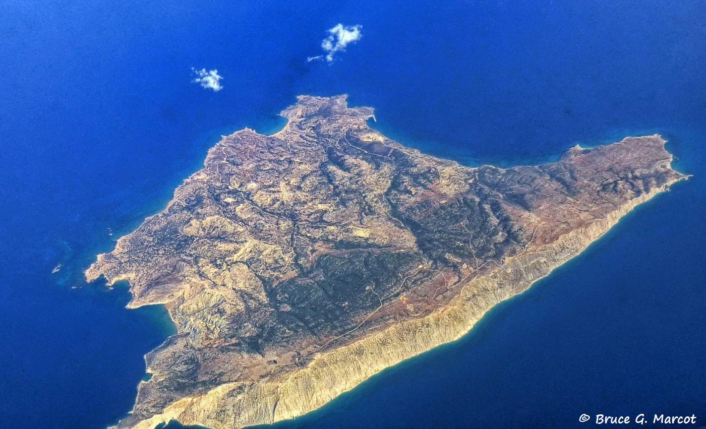
Gavdos Island |
Credit & Copyright: Dr. Bruce G.
Marcot
|
Explanation: This looks like a bare and lonely place, but it is a most interesting dot of land. We are flying over southern Greece, and below us zips by the island of Gavdos, surrounded by the Libyan Sea. Why do I call it "on the edge?" Well, it is the southernmost island of Greece. Just to the north is the far larger and more famous island of Crete. Gavdos is, in fact, part of the Chania Regional Unit portion of Crete. Gavdos is also as far south as you can go in the European continent. It's where Odysseus shipwrecked en route to Troy, according to Homer. It is closer to Africa than to Athens! The green on the island, visible in the photo here, is junipers and shrubs, but there is no fresh water on the island. There is no source of power other than generators to supply the approximately 60 island residents with intermittent electricity. Studies have
been conducted on the paleontology of the island. There is an important
sea-level monitoring site on the island where the tides are small so that
change in sea level is easier to determine.
|
Next week's picture: China Fir in Dali
< Previous ... | Archive |
Index |
Location | Search | About EPOW | ... Next >
Google Earth locations
shows all EPOW locations;
must have Google Earth installed
Author & Webmaster: Dr. Bruce G. Marcot, Tom Bruce
Disclaimers and Legal Statements
Original material on Ecology Picture of the Week © Bruce G. Marcot