|
|
|
A Global Arc |
|
|
Click on images for larger versions
|
|
|
A Global Arc |
|
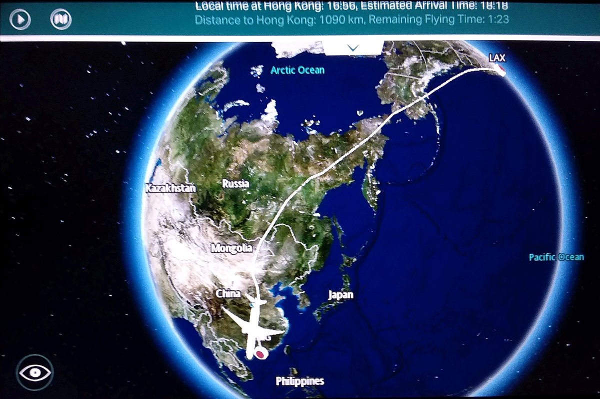
top: Actual Flight Path |
Credit & Copyright: Dr. Bruce G.
Marcot
|
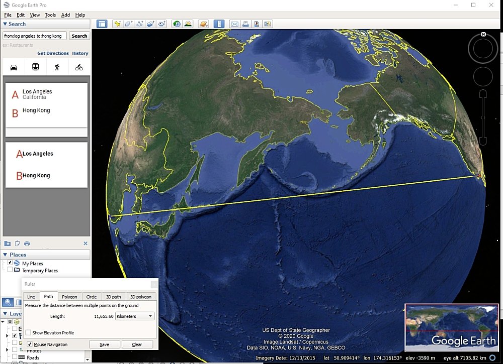
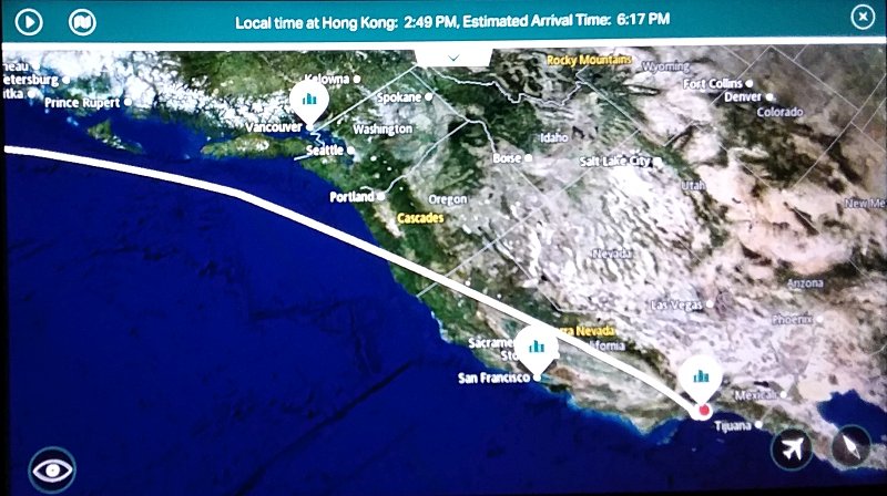
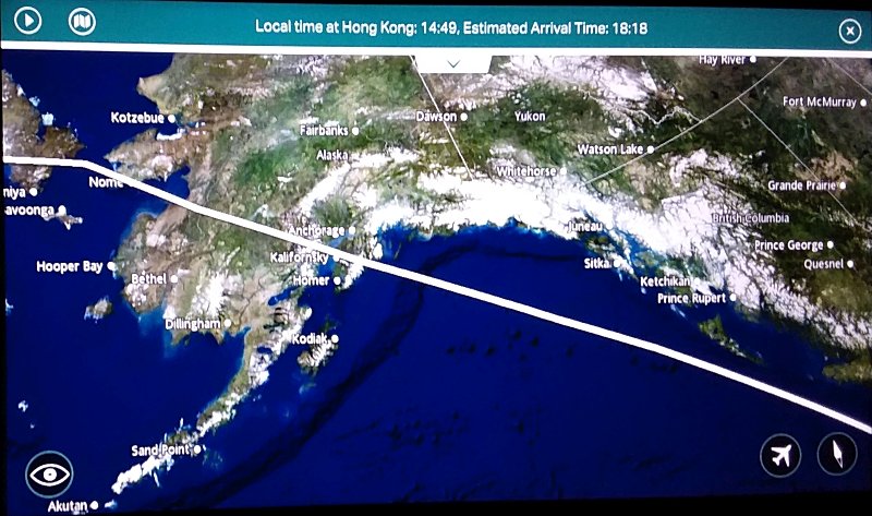
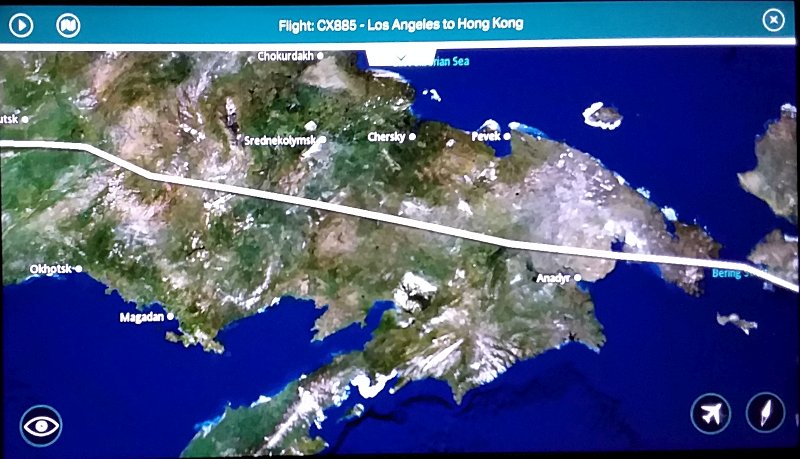
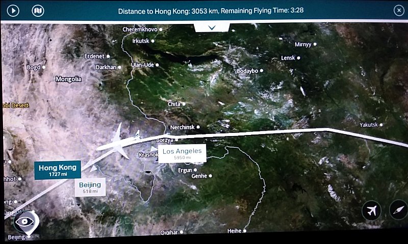
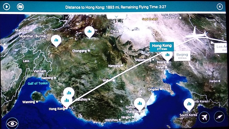
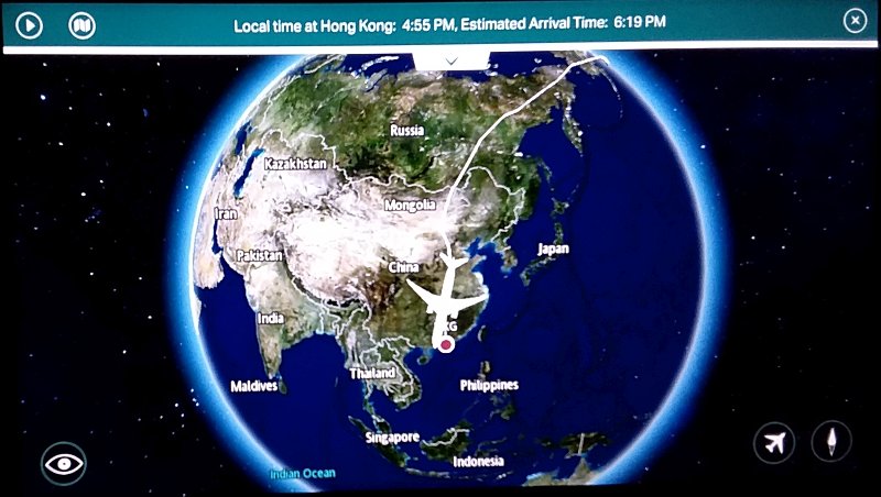
Explanation: So there I was, on an international flight from Los Angeles International Airport to Hong Kong. The screen in front of me was displaying our flight path. Soon I realized that we were curving further north than we would if we wanted to take the shortest route. A shortest route on a curved sphere is called a great circle (because, if extended around the circumference, its plane would cut through the center of the sphere). It's still curved, of course, because we're on a sphere (flat-earth theory aside...). I found it most interesting to track our flight path ... shown in the main top image, above ... and to later compare that to the shortest great-circle path that I plotted in Google Earth ... shown in the main bottom image, above. Our actual flight path, as also shown below here in successive, zoomed-in screen captures from the plane's display, passed north over Portland (where I just flew from!) ... then over mainland Alaska ... into Siberia and the Russian Far East ... over eastern Mongolia ... over mainland China ... and finally down into Hong Kong. The shortest great-circle path, on the other hand, would have remained over the Pacific Ocean, just skirting Alaska's Aleutian Islands, missing Russia entirely, flying over the northern island of Hokkaido Japan ,skirting South Korea, and straight on to Hong Kong. Why fly the longer, further distance? It is to maintain some proximity to land and airports for potential emergency landings ... although on many other of my flights between western North America and Australia and New Zealand, over the immense Pacific Ocean, there is no practical opportunity to do so, and much of the flight time is over open ocean, save for some scattered South Pacific islands.
|
Next week's picture: Pacific Sand Crab
< Previous ... | Archive |
Index |
Location | Search | About EPOW | ... Next >
Google Earth locations
shows all EPOW locations;
must have Google Earth installed
Author & Webmaster: Dr. Bruce G. Marcot, Tom Bruce
Disclaimers and Legal Statements
Original material on Ecology Picture of the Week © Bruce G. Marcot