|
|
|
Kasai River, Remote and Red |
|
|
6-12 June 2011
Click on images for larger versions
|
|
|
Kasai River, Remote and Red |
|
Kasai River, Kasai
Province |
Credit & Copyright: Dr.
Bruce G. Marcot
|
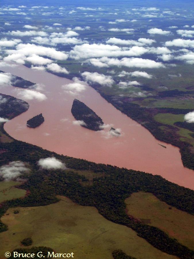
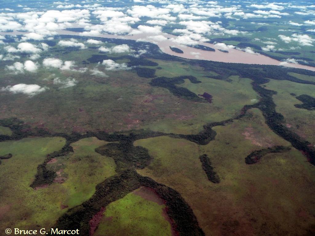
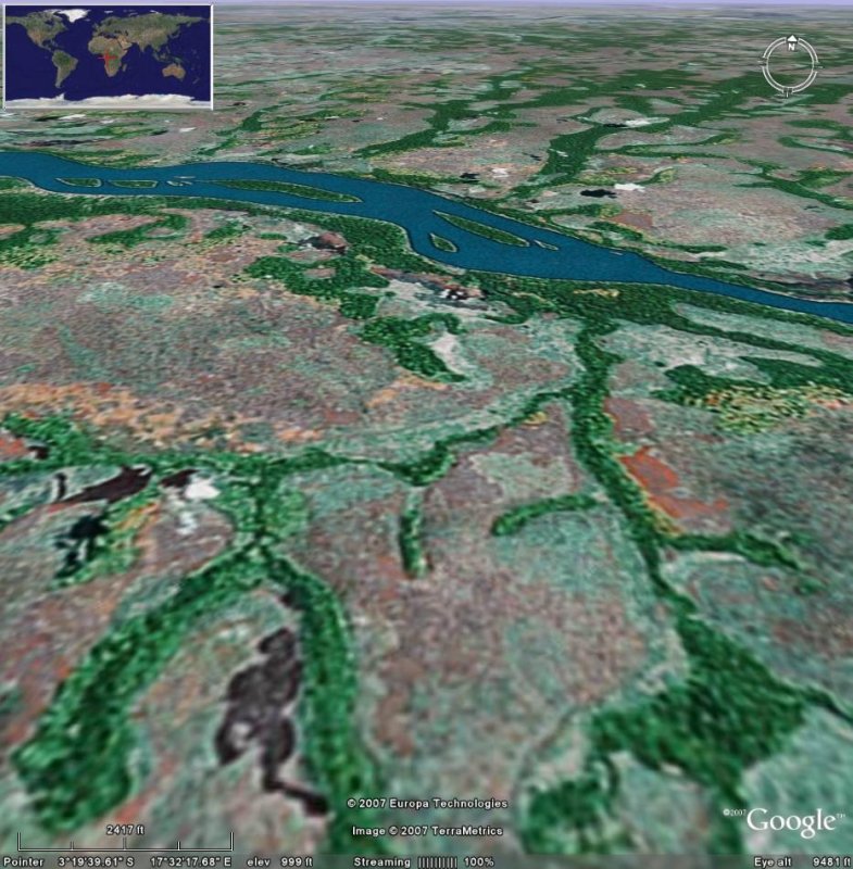
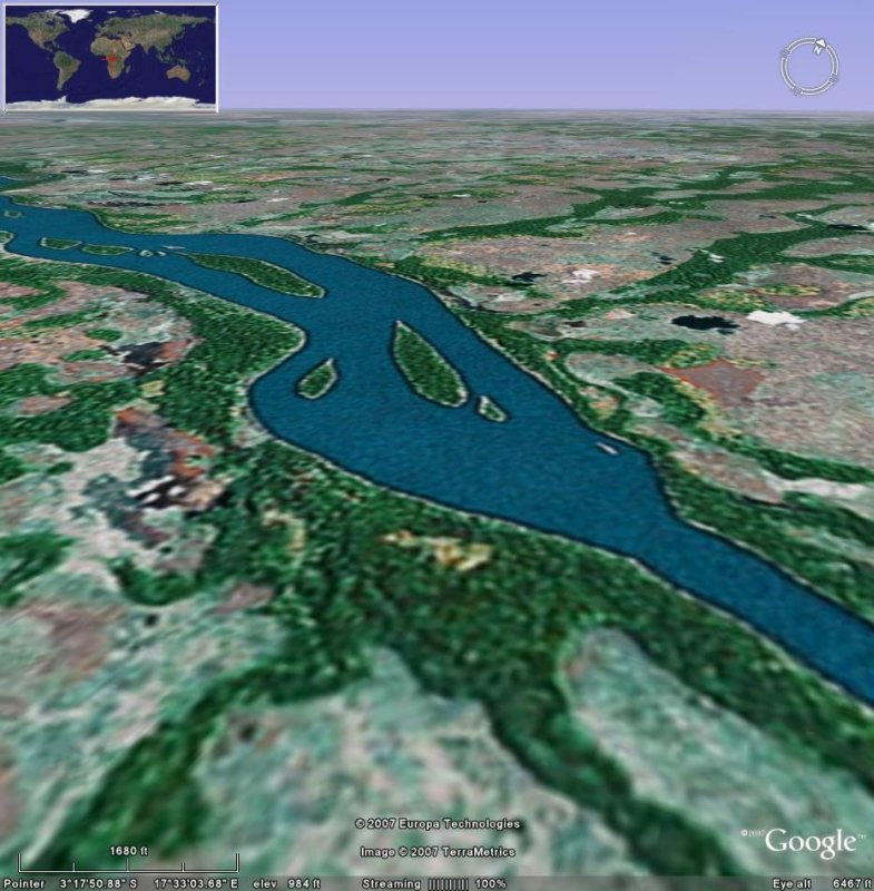
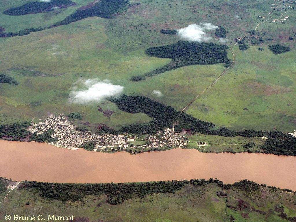
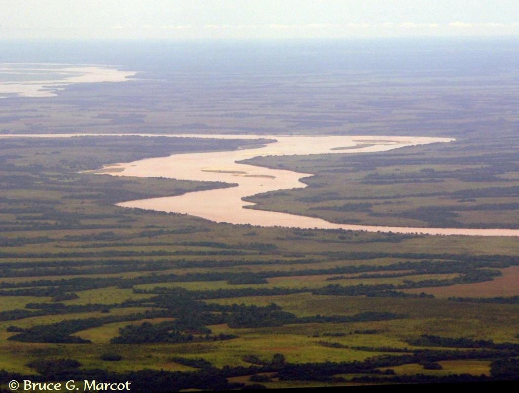
Explanation: Into the remote heart of the Congo River Basin stretches this immense tributary of the Congo River. This is the Kasai River that stretches and bends over 1300 miles (2100 km) from Angola into the Democratic Republic of the Congo. Here, the Kasai forms a striking contrast with the savannas and the patches and stringers of tropical woodlands, below. Islands of dense forest punctuate the twisting river course, and only occasionally a village may be seen along its edge. What makes the Kasai unique among the many other vast Congo tributaries, however, is not its remoteness, but rather its redness. Why is the Kasai so red? I asked that question of my Congolese hosts and friends, but none had a satisfactory explanation other than perhaps it is a heavy sediment load that the river carries. But why the Kasai appears so burnt orange while other rivers of the region do not, I haven't yet discovered. Nor how its apparent opacity might influence its ecology. These rivers seem to all carry catfish and other bottom-dwelling species that can thrive in highly sedimented conditions. But the Kasai seems to harbor a high biodiversity despite its apparent turbidity.
Occasionally, riverside villages
have grown up along the banks,
As far as one can see, this remote interior of the Congo
River Basin
|
Next week's picture: The Tree That Feeds the Fish
< Previous ... | Archive |
Index |
Location | Search | About EPOW | ... Next >
|
|
Author & Webmaster: Dr.
Bruce G. Marcot
Disclaimers and Legal
Statements
Original material on Ecology Picture of the Week ©
Bruce G. Marcot
Member Theme of The Plexus